The Joy of Bookshops: Zabriskie, Berlin

Why do we love bookshops? For me there are two main reasons for loving a bookshop, each related to the type of establishment they be. The first is the cavernous hall, or the seemingly endless collection of rooms, with shelves from floor to ceiling. It is, on first glance, overwhelming. It smells of dust and leather and childhood. If you give it time, your explorations will be rewarded. It is a bookshop as a journey of discovery, to see what you might find and take home with you.

The second reason, and the second type of bookshop, is very different. It is a place with a purpose. It is the vision of one, two or a small group of people. It is a reflection of taste, of specific interest or passion. It is a place with identity, beyond simply ‘books’. And this, on a leafy side street in Berlin-Kreuzberg, across the road from a supermarket and a short walk to the banks of the canal and the urban hustle and bustle of Kotbusser Tor, is where we find Zabriskie.

‘You really need to visit Zabriskie… it is exactly our type of place.’

This was Julia, a few weeks ago before we had one of our periodic meetings to see each other face to face and have a chat about Elsewhere before meeting another friend for a drink. We live on opposite sides of the city and do not see each other in person that often. Indeed, Elsewhere in general is a print journal created thanks to the communication possibilities of technology, a throwback publication that needs the 21st century internet to survive. In any case, Zabriskie in Kreuzberg (Julia’s side of the city) had agreed to stock the journal a few months ago and ever since she had been urging me to go and have a look at this bookshop that was ‘exactly our type of place’.

She was, she is (of course) exactly right. 

Zabriskie is the brainchild of Lorena and Jean and is subtitled ‘Buchladen für Kultur und Natur’. Culture and Nature. The small-but-perfectly-formed selection of books reflects the owners’ interests and passions and brings together in English and in German some of our favourite writers. As I browsed their shelves, titled ‘Natural History’, ‘Counterculture’, ‘Utopias’, ‘Travel’ and more, I saw so many of the names that sit on my shelves at home. Solnit, Sebald and Macfarlane. Orwell, Chomsky and Deakin. There were books about identifying wild plants and musical revolution in Brazil, a portrait of Iran and the art of surviving the 1980s. The shelves house William Morris’ News from Nowhere and Jack Kerouac’s Dharma Bums, as well as handbooks for new beginnings and field guides for getting lost. The room is small but it contains worlds, as the best bookshops do and I could have spent hours exploring their selection.

As befitting the first bookshop we have written about on our blog, Zabriskie’s name is itself intrinsically linked with place. Zabriskie Point in Death Valley gives its name to a Michelangelo Antonioni film from 1970 that has this location as a symbol of the soul of the wilderness that is threatened by new real estate development. Fittingly, for a shop that takes its name from one of the cult films of American counterculture, Lorena and Jean describe their bookshop as a place that concerns itself with cultural phenomenon that sit out of the range of the mainstream radar. What is also wonderful is that they not only promote writers of such topics, but they also offer support and visibility to independent publishers and small presses such as ourselves. 

Nature and Culture. When I flick through the first three issues of Elsewhere I think there is a lot of both contained within our pages. It is fantastic that our city houses a bookshop where our journal feels so at home. If you ever find yourself wandering the streets of Berlin, in search of inspiration, you will find it not only in the people, the buildings and the stories of the city, but also on the shelves of Zabriskie. 

Zabriskie (website)
Manteuffelstr. 73, 10999 Berlin (googlemaps)

We love bookshops and we will be profiling some more of our partners who support us by selling Elsewhere in the next couple of months.

From The Pigeonhole: Sixty Degrees North - an Extract

PHOTO: MALACHY TALLACK

PHOTO: MALACHY TALLACK

Readers of Elsewhere will know we are big fans of Sixty Degrees North by Malachy Tallack. First published by Polygon, the book will be serialised to UK and Commonwealth readers on The Pigeonhole, starting from 19 May 2016. Readers will receive one digital instalment every three days via The Pigeonhole’s iOS app or on any web reader. The serialised edition will include extra content such as interviews and maps, and readers will be able to leave comments for each other and for the author within the text itself. To mark the publication on The Pigeonhole, we are extremely pleased to present this extract from the book:

Geography begins at the only point of which we can be certain. It begins inside. And from there, from inside, rises a single question: where am I?

Imagine yourself stood upon a hill. Or better, imagine yourself stood on a tall hill on a small island, the horizon visible in every direction – a perfect, unbroken line. From early morning until late in the night you stand there. You watch the sun rise from one side of the island and arc its way above, moving slowly and predictably through the sky until it reaches the opposite horizon, where it gradually disap­pears. As the light fades, stars freckle against the mounting darkness. They too turn about you, on an axis rooted at the North Star, Polaris. This great arena of night and day seems to roll over the stationary world and surround you with its movement. And that question rises: where am I?

The universe that we can see is a place of mirrors and illusions, tricks of the eye and the mind, and it takes a great leap of scientific faith to come to terms with the facts as we now know them to be: that nothing is still; that both our universe and our planet are in ceaseless motion. To look upwards and to acknowledge this is to take a nauseating lurch of the imagination. It is to be overwhelmed not just by a feeling of insignificance, but of fear, vulnerability and exhilaration. Amid all this movement, this unfathomable distance, it seems somehow impossible that we could be anywhere at all.

But our understanding of where we are on the Earth has not been built with this celestial motion in mind. Since people first began to use the sun and stars as navigational aids, they have done so by being ignorant of, or by ignoring such disorientating facts. That the North Star is not a stable point within the universe does not matter so long as it seems to be a stable point. That the sun does not turn around the Earth makes no difference if it continues to appear to do so, and that its appearance is predictable. For the roots of that question – where am I? – are not so much philosophical, nor exactly scientific; they are practical. Where we are only truly makes sense in so far as it relates to where we have been and where we want to be. In order to move in a purposeful way, to avoid wasting our time and endangering our lives, we must build an image of our location, and where we stand in our surroundings. We must make maps.

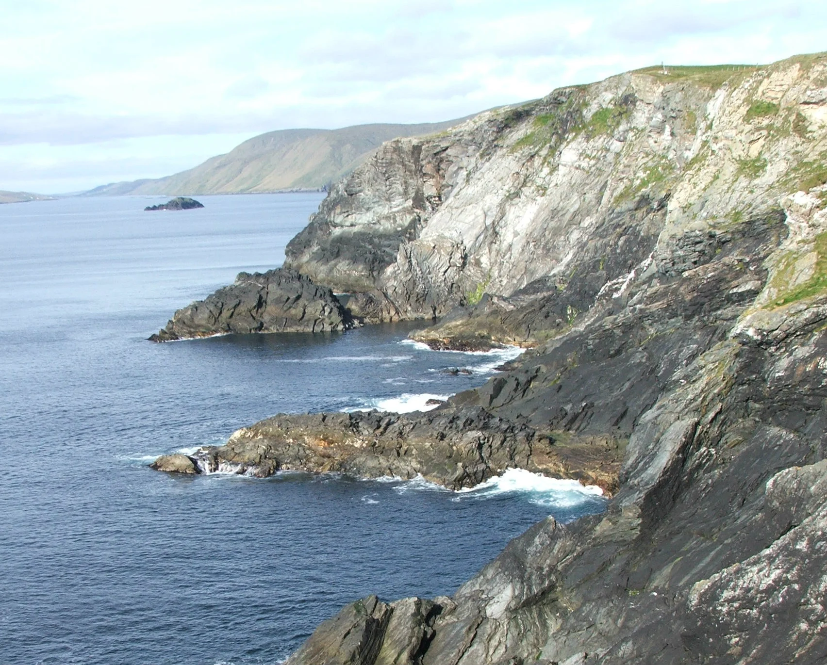
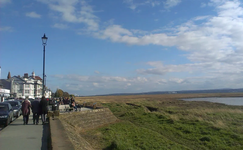
I stared out at the calm ocean, at the tide lines laced like skeins of white hair. I looked towards the horizon – blue fastened to blue – and beyond, towards unseen places: to Greenland, to North America, to Russia, Finland, Scandinavia and back here again across the North Sea. I looked out for several minutes, then felt ready to go. I turned and walked up the hill, alongside the fence. From my starting line at the cliff I made my way back along the parallel, glad to be moving again.

Soon, the lavish green that had fringed the shore gave way to low heather and dark, peaty ground. The land flattened into a plateau of purple and olive, trenched and terraced where the turf had been cut. White tufts of bog cotton lay strewn about the hill. Shallow pools of black water crouched below the banks of peat and in the narrow channels that lolled between. I hopped from island to island of solid ground, trying to keep my feet dry, as a skylark hung frantically above, held aloft by the lightness of his song.

After only ten minutes or so I was walking downhill again, into the lush valley that folds around the loch of Vat-setter and the Burn of Maywick, flanked by bright yellow irises. The thick heather faded back into a lighter, leaner green, and on the opposite slope was a field, striped by cut silage. A gust of golden plovers sprang suddenly from the ground ahead, and curled its way over the valley. Two lap­wings crossed their path above the loch, guttering towards the sea with a clumsy kind of grace. I watched the birds until they tumbled out of view, and then continued to the burn below.

The steep descent into the valley meant an equally steep climb out again, on a gravel track that, according to the map, crossed back and forth over the parallel several times before waning into nothing. I carried on, and was soon back amid the peat. The hill rose sharply to 200 metres, and I was hot from the walking, but it was worth it. As I reached the higher ground, the air opened up without warning, and I could see from one side of Shetland to the other: the Atlantic behind and the North Sea in front. Above, wisps of cirrus cloud were combed across a bold sky, as wide as any sky I had ever seen before.

Human beings have always moved from here to there, from one place to another, with a combination of memory, acquired knowledge and curiosity. We have made use, most commonly, of internal maps – remembered routes from one point of significance to another: a place of food, a place of shelter, a place of danger. Elements of these maps would have been passed from generation to generation, in songs and in stories. They were embellished, updated and, if necessary, discarded. These are living maps, where space and direction are sealed off and separated from the world outside. They can be as intricate and mysterious as the songlines of the Australian Aborigines, or as straightforward as remembering how to reach the shop from your front door.

To build a more concrete image of where we are it has been necessary to externalise our maps: to make pictures of the world. The very first visual maps were of the stars, such as those on the walls of the Lascaux caves in France, drawn more than 16,000 years ago. But looking up at the sky is easy. To draw a picture that could encompass a particular space on the Earth, or encompass the whole planet even, is a far greater challenge. The mapmaker is forced to become other than himself, to imagine the view of the birds. The mapmaker must look down from above and become godlike, re-creating his own world.

Unlike internal or ‘story’ maps, early world maps were intended as scientific or philosophical exercises rather than navigational guides. Their practicality was limited by two significant factors. Firstly, the ancient Greeks who pioneered cartography had limited geographical knowledge. Centred on the Mediterranean, their maps extended eastward only as far as India, with their westward edge at the Strait of Gibraltar. Beyond these boundaries the world was more or less unknown, though speculation about the grotesque barbarians dwelling in northern Europe and Africa was widespread. The other major problem for the Greek map-makers was their lack of a practical means of representing distance and shape accurately. What was required to do this was some kind of scale or grid, which could be applied both to the spherical surface of the Earth and, potentially, to a globe or a flat map. That grid was provided in the second century BC, when Hipparchus of Nicaea devised the system that we still use today: measuring the Earth in degrees of arc. Although similar methods had been proposed previously by the Babylonians, Hipparchus’ achievement was to divide a circle into 360 degrees of arc, and so provide the foundation stone for trigonometry.

A degree was a measurement of the angle at the centre of a circle, between one radius and another, like the hands on a clock. If the time is three o’clock, the angle between the two hands is 90°: one quarter of a full circle. On the outside of the circle, the points where the two radii, or hands, touch the edge can also be said to be 90° apart. This measurement could further be applied to spheres, like the Earth, with the north-south angle denoted by one measurement – latitude – and the east-west angle by another – longitude. It was then pos­sible, at least theoretically, to give co-ordinates for any place on the planet, and that information could further be used to represent geographical space accurately on a map. This was a revolutionary step for navigation and for cartography.

Whereas longitudinal lines, or meridians, are of equal length, running through both poles, and dividing the planet like the segments of an orange, circles of latitude are parallel lines, progressively decreasing in size, from the planet’s full circumference at the equator to a single point at the Poles. They are represented as an angle up to 90° north or south of the equator. At 60° north, where I was standing, the parallel was half the length of the equator, and two thirds of the way to the Pole.

For the Greeks, the pinnacle of their cartographic tra­dition came in the mid-second century AD, in Roman Alexandria. It was here that Claudius Ptolemy created his Geographia, a work that gathered together the geographical knowledge of both the Greeks and the Romans. Ptolemy gave co-ordinates for around 8,000 places, stretching between his Prime Meridian at the Fortunate Isles (Cape Verde) in the west, China in the east, central Africa in the south and Shetland, which he called Thule, in the north. This was the known world, reaching 180 degrees in longitude and eighty in latitude, and Shetland then was at its very edge. Despite all but disappearing for more than 1,000 years, the influence of this book, eventually, was immense.

Today, we need only consult a map to learn of our location, or just press a button on our handheld GPS or phone, which can tell us our longitude and latitude in degrees, minutes and seconds of arc. But still somehow that question feels unanswered, still it gnaws at our certainty. Where am I? 

Readers from the UK and Commonwealth can subscribe to the serialised edition of Sixty Degrees North on the Pigeonhole here.

Read our review of the book here.

The Library: Stefan Zweig's Journeys – On memories and places

Review: Paul Scraton

Throughout his life Stefan Zweig was a traveller. The Austrian writer made numerous journeys in Europe, criss-crossing the continent by train. They began as trips of leisure and inquiry, for the summer season of 1902 in Ostend or a trip in 1904 to explore the ancient streets of Bruges. By 1934 he was travelling for a very different reason; a Jewish writer in exile following the rise to power of the Nazis. First to England and then to the United States, before one, final, journey to Brazil where he committed suicide with his wife.

This collection of travel essays does not take Zweig beyond Europe, beginning as it does with that trip to Ostend in 1902 and ending, in England, with the ‘Gardens in Wartime’ of 1940. Presented chronologically, the essays that make up Journeys comprise a journey as a whole, through time and a changing Europe, one which begins with the security and stability of the Austro-Hungarian Empire of Zweig’s childhood and early adulthood and that passes through World War I, the flux of the aftermath, the rise of the Nazis and the (beginnings) of the horrors to come. 

Zweig’s own feelings about the transformation of the continent in those first decades of the 20th century can be read in his 1942 memoir The World of Yesterday - completed the day before he committed suicide – but it can also be felt in this collection, as the excellent translator Will Stone comments in his fascinating introduction to the book:

“It would probably be true to say that as Zweig gains experience as both a traveller and a writer, especially after the trauma of world war, his essays exhibit more depth and his concerns take on more urgency.”

And it does feel, as in his later memoir, that World War I is a defining period in Zweig’s life, such a violent upheaval that transformed the world he knew into the World of Yesterday, changing him as both man and a writer. On a personal level, as someone who has spent a lot of time thinking and writing about place and memory, and places that become ‘sites of memory’, it is the essay on Ypres that I return to time and again.

The essay is written in 1928, ten years after the end of World War I and in it Zweig is reflecting on the nature of how the battlefields of Flanders had become a tourist destination. The first Thomas Cook tours had begun barely months after the cessation of the hostilities, with the guns still warm and the landscape still scarred. Stefan Zweig writes:

“Presently the name of Ypres, the ville martyre, shouts from all the posters, from Lille to Ostend, from Ostend to Antwerp, and far into Holland. Organised tours, excursion by automobile, individually tailored visits; it’s a veritable bidding war. Every day some ten thousand people (perhaps more!) come to pass a few hours here: Ypres has become Belgium’s star attraction.”

This is something that I think about a lot, especially here in Berlin where it feels as if there is a memorial on nearly every corner; where it is possible to watch people climbing on the Memorial to the Murdered Jews of Europe, playing hide and seek or holding fashion shoots among the columns; where it feels, like Ypres does to Zweig, that the whole city is a ‘site of memory’. I have long come to the conclusion that this is a necessary process, and indeed when I have written about the subject of tourism and sites of memory it is a Zweig quote from this collection that always comes to mind:

“Nevertheless: it is good that, in some places on this earth, one can still encounter a few horrifying visible traces of the great crime. Ultimately it is something good too when a hundred thousand people, comfortable and carefree, clatter through here annually, and whether they care for it or not, these countless graves, these poisoned woods, these devastated squares still serve as reminders… All that recalls the past in whatever form or intention leads the memory back towards those terrible years that must never be unlearned.”

Sadly, this is the other power of this collection. Alongside his sharp observations, well-written descriptions and thoughtful reflections, as the essays progress there is something else at work that has nothing to do with the writer and everything to do with the reader: our knowledge of what is to come, especially in the later essays. For however comfortable and carefree those visitors were in 1928, there would soon be more graves, more woods poisoned and more squares devastated. The lessons were indeed unlearned. It is perhaps this realisation that led Zweig to take his own life across the ocean as the continent he loved was consumed by war once more. And it gives these essays a melancholy power, beyond simply the nostalgia for times gone by and places changed beyond recognition. It is not so much that they have changed, but the how and the why. 

Journeys by Stefan Zweig, translated by Will Stone, published by Hesperus Classics, 2010.
Tourism and Sites of Memory, an essay by Paul Scraton appears on Traces of a Border.

Elsewhere No.03 featuring writing on place, interviews and reviews, is out now and available via our online shop.

Postcard from... the Marginal Way

It is barely two kilometres long, this path along the low cliffs and shoreline in Ogunquit on the Maine coast, and yet the Marginal Way is so popular, has become so many people’s “favourite spot”, that the local authorities have had to limit the number of memorial benches erected above the bayberry bushes, the rocky outcrops and the surf. In summertime it must be a procession, a stream of slowly moving sandals and shorts from the beach to the harbour at Perkin’s Cove and back again, but over Easter weekend it still feels decidedly off season. Many of the hotels and guesthouses remain shuttered and closed, and the wide expanse of Ogunquit beach was empty this morning save for a couple of hardy strollers and some cold-resistant surfers clad in black wetsuits from head to toe. 

Up on the path our fellow walkers are enjoying the early spring sunshine, but the dresscode is decidedly more Gore-Tex than Gap beachwear, as the wind blows in off the ocean and the swell breaks on the rocks down beneath where we walk. The houses whose gardens run down to the path and the edge of the cliffs are grand, picturesque piles that must have cost piles, and there is a pleasure in knowing these views out across the Atlantic cannot be completely bought and are available to all via the Marginal Way. 

We pause on a memorial bench – one that got past the waiting list currently pushing 100 – and then press on to Perkin’s Cove. There is some signs of life here. Shops selling overpriced, nautical souvenirs are open, as are the galleries of average but well-positioned local artists. Lobster rolls cost 20 dollars, but on the quay car parking spaces are still reserved for local fishermen and the small print of the menu tells us the shellfish in the roll was brought ashore by the owner himself. In a month or so we could catch the trolley train home, but it remains locked away in its whitewashed, clapboard garage, so we head back the way we came, along the Marginal Way, hugging the Atlantic shore.

The latest edition of Elsewhere is out now. You can order Elsewhere No.03 for €12 including worldwide shipping via our online shop.

The Possibility of the Train

At the station the destinations rattle around on the departures board until they settle, a list of times and places and platforms that tells hundreds of stories. On line one, the commuter heading home to the suburbs after another day in the city. Had she imagined the hours she would spend on that line, back and forth, back and forth, day after day? On line two a link to the next city, for a football match or to visit and old school friend, waiting at the station. On line three a train that will cross borders, cross continents. That will leave from the bowels of this station with some passengers who will only alight in a couple of days time. It is these that grab the traveller who grew up on an island, at a time and in a place where an international train involved a ferry. WIEN. PRAHA. WARSZAWA. MOSKVA. MINSK.

The same thing happens at home when we flick through the latest copy of the European Rail Timetable and its mix of places, times and symbols. Through service (1st and 2nd class). Couchette car. Snacks and drinks available. Sundays, Saturdays and Bank Holidays. Reservation compulsory. Shipping service. Sleeping car. Frontier station.

The possibility of the train.

Even when we are catching that suburban commuter line to just beyond the city limits, or the regional train to the coast, there is an excitement to be found. It is the freedom of movement, through the carriages to the dining car (if such a thing still exists). It is in the conversations with strangers (when they look up from their mobile phone). It is in the lives observed, over the railway embankment and across the back gardens. She is doing the dishes as the train goes by. He is smoking a fag on the balcony. The football is heading straight for the window. Did it hit or did it miss? We’ll never know. Low bridge. Story frozen.

Familiar journeys take us through landscapes we can see ourselves in. A walk through the woods in the winter that passed beneath this line. A streetcorner where we waited to meet friends before the cinema. A town where we spent a weekend, years ago. New journeys have us staring out of the window, whether it is a flat featureless landscape or the industrial outskirts of a city, the first glimpse of the mountains or the spires of an old town emerging as the train follows the bend of a river. The best thing about the train is that the adventure starts the moment you reach the station. The journey is part of the experience. Even if we are getting off only two stops down the line.

One morning we caught the train to Prague. PRAHA. Even after all these years, a train to another country is something to marvel at. The carriages were Hungarian (as were the waiters in the dining car and the bottles of beer they brought to our table). We sat in a compartment with a young couple, also heading to the Czech capital. Their first weekend away? He was nervous, solicitous. It took her until Dresden to get the annoyance of something her mother had done out of her system. After Dresden we were all looking out of the window as we followed the river. As the train passed through Swiss Saxony and across the border, the Elbe flowing swiftly beside us, we imagined future trips where we would get off before now. To walk in those hills. More possibilities of the train.

I remembered this journey from years ago. Sharing a six pack with a friendly German guy before I could speak his language. It didn’t matter, as his English was good. He was from Hamburg and was on his way to Budapest. The whole way. They still checked your passports then, with suspicious glances under peaked hats at aged faces. The passport stayed in the bag this time, and it was hard to spot the border. On the opposite bank we could see the old checkpoints but for a short while the river was the border and we could not tell at which moment we crossed. There? There? Look, the road signs have changed. The number plates too.

The first glimpse of Prague was spectacular, of the babies crawling up the television tower and the castle emerging above the red roofs of the city centre. I had seen it before, many times. The last time I came we travelled by car, arriving with a stressful drive of missed turnings and one-way streets driven the wrong way, and the rest of the visit was not much better. I had loved Prague, and in those few days, overwhelmed by the crowds and the noise, I lost my feelings for the city. For ten years I did not return. And now, on the train, I felt the excitement of arrival once more. The journey was part of the trip and would prove to be a fine omen. I had my Prague back and it all began in that Hungarian railways compartment. The possibility of the train indeed.

Words: Paul Scraton, Photos: Katrin Schönig

We love trains so much we had a feature devoted to the Night Train in Elsewhere No.02. If you haven’t read it, you can get your hands on a copy via our online shop, where you can also buy sets or subscribe to the journal. Elsewhere Online Shop.

For trip planning and adventures of the imagination, you get your hands on the European Rail Timetable here.

Postcard from... Parkgate

By Paul Scraton:

On the promenade we squeezed past our fellow strollers as we made our way down between the row of parked cars and the sea wall towards the famous ice cream shop. Outside the chippy lads poked at polystyrene trays with wooden forks and through the window of the tea room it was possible to imagine the sound of a tiny spoon landing on china. It was a typical scene at a genteel seaside village, with a view out across the water to the Welsh coast and a hint of the mountains in the clouds beyond. But Parkgate is a little bit different, as seaside villages go, because – despite the fish and chips and the ice cream, and the call of the gulls circling in search of scraps – when you look out from the promenade it is not across an expanse of golden sands, but of waving grass and glassy ponds.

From the 18th century until the 1920s, Parkgate was a popular port – for travellers aiming for Ireland – and seaside resort. Photographs in the ice cream shop showed bathers stepping down from the promenade and onto the sands. But change was coming. As the River Dee silted up, Parkgate became unusable as a port and then, with the spread of colonising grass, the beach became overgrown, gradually transforming into the expanse of marshland between the river and dry land that is what visitors look out across today. Still, the seaside strollers in search of ice cream and chips still make their way to Parkgate, joined by the birdwatchers who come to catch a glimpse of the species that live or pass through the Dee Estuary Nature Reserve.

We stood in a queue for our cones of vanilla or mint choc chip, and then crossed back over the street to the place where passengers were once ferried out to deeper water for the boat to Ireland. Whatever future changes will come to Parkgate, you somehow get the feeling that the ice cream will remain.

Elsewhere No.03, featuring great writing on place, illustration, photography and reviews, is out now and available via our online shop.

Printed Matters: Writing Maps - Write Up Your Street, Writing The Love, Writing People

Writing Maps by Shaun Levin
Words: Marcel Krueger

These days, a good map is hard to find. With a variety of location services installed in smartphones, cars, and even glasses, it seems to me that the art of appreciating and even reading a map is slowly but surely dying. But then maps have never simply portrayed landscape in reality - just look at Tolkien’s self-drawn maps of Middle Earth or Martin Vargic’s Map of the Internet. Maps have always enabled us to understand abstract and imagined facts and ideas, so why not take this up a notch and release maps from their traditional purpose completely?            

Enter Shaun Levin, writer and creative writing teacher. Shaun has published short stories, novellas and non-fiction, and is the founding editor of the literary journal Chroma and the director of Treehouse Press. He also publishes the literary magazine The A3 Review (also as a folded map-like publication) and a series of notebooks featuring writing prompts, with so far three volumes out: City, Food and Family. In 2012, Shaun launched the first in a series of “Writing Maps”, illustrated creative writing prompts to inspire writers on the go. As Shaun states: “Together with some exceptionally talented illustrators, my aim is to create a source of inspiration that draws on my love of writing and the ways it enriches and intensifies our engagement with the world.”

For Elsewhere I’ve reviewed three different maps with city writing as overall topic, named Write Up Your Street (illustrated by Andy Carter), Writing The Love (illustrated by Isik Bagraktar), and Writing People (illustrated by Andrew Sutherland). Each map has a distinct individual style, ranging from monochrome images of buildings in Write Up Your Street - my personal favourite - to the city represented as a colourful beating heart in Bagraktar’s map. All maps contain at least 12 extended writing exercises that will help a writer explore the city and the writing process, plus a reading list and quotes befitting the topic of the respective map. According to Shaun: “Writing Maps are created to suit writers of all genres and levels, and have been devised with adult writers in mind.” Overall 18 writing maps have been published so far, with locations ranging from beaches to art galleries to the body itself.

What I like about the maps is that while they might not lead you to a specific location in your city or neighbourhood, they enable everyone to use every-day surroundings and encounters as writing prompts. One might argue that this is just standard creative writing course material wrapped in fancy paper, but I might beg to differ: for me, any reason to leave the house and go for a stroll is a good one, and if I have a map with me that makes me write - even better. These maps are not the latest in cutting-edge abstract cartography, but lovely little things for anyone who can do with nudge towards creativity on the go. Bring them with you if you are ever stuck with a piece of writing and, to paraphrase Nietzsche, need to conceive some great thoughts while exploring your city.

Published via http://www.writingmaps.com/

Postcard from... Cwm Llan

By Paul Scraton:

From the car park we followed the procession of bank holiday walkers aiming for the top of Snowdon via the Watkin Path. Throughout the day the summit of Yr Wyddfa would remain in clouds, and descending walkers told us of the cold winds on the ridge and poor visibility. We were not aiming that high, just following the path long enough to turn the corner into Cwm Llan and up to the old slate quarries that stand in the shadow of the great mountain. Beneath huge piles of slate we picked our way through the remains of the old barrack buildings, standing solid-if-roofless on the boggy ground.

We tried to imagine what life was like for those working these quarries high in the mountains, tried to imagine the working conditions and the weather, but we failed. We could read about it, learn of the low wages and the poor life expectancy, but there would still be a gap in our understanding. We headed back down via the old tramway that had moved the slate down off the mountain to where it could be transported on to Porthmadog. It was a reminder that even the “wild places” of Britain are shaped by human hands… or the sheep they release to graze there.

Elsewhere No.03 is out now - order your copy via our online shop.